Fewer people are running red lights and motorists have slowed down to get closer to the speed limits at the sites of Greater Sudbury’s automated traffic enforcement cameras.
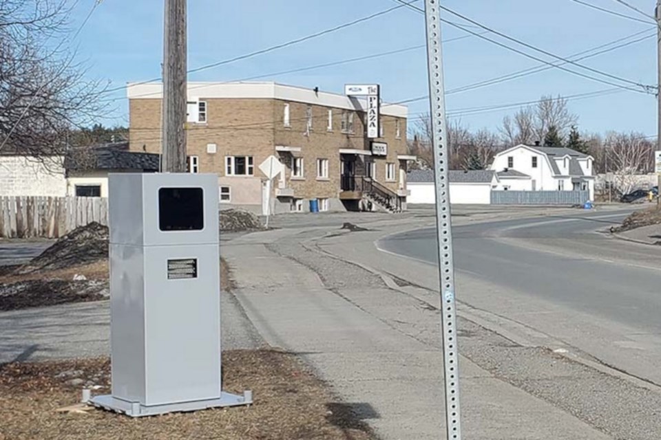
These include six fixed red light cameras and six mobile automated speed enforcement cameras which change locations every few months. The roving speed cameras have been the frequent target of vandalism since they were installed earlier this year.
A report by city Traffic and Transportation Engineering analyst David Knutson was tabled for the Nov. 18 operations committee meeting of city council, and outlines the cameras’ successes.
The success of the city’s six red light cameras weren’t as clearly defined as the speed cameras, though Knutson’s report notes a slight drop in right-angle collisions, with five recorded in 2023 and 16 recorded in the pre-pandemic year of 2019.
Data regarding rear-end collisions, which often increase at locations with red light cameras, is incomplete and does not show a correlation.
Meanwhile, 9,105 charges have been issued between the start of the red light camera program in September 2022 and the end of August, with notable decreases during the winter months and this year’s summer peak spiking at just north of 400 per month, which is approximately 200 incidents shy of the previous two years’ peak of more than 600.
“A lower instance of tickets being issued directly results from less motorists running the red
light and therefore eliminating the potential for a collision to occur when doing so,” Knutson’s report concludes.
Automated speed-enforcement cameras, meanwhile, resulted in “a significant decrease in operating speeds while the units were operational,” with a slight lasting effect on operating speeds at the majority of locations after they’ve been removed.
During the first round of deployment, 2,295 tickets were issued for speeding offenses.
At the six cameras’ second location, 3,066 tickets were issued.
At all 12 camera locations, 85th percentile speeds dropped when cameras were present, to within a few kilometres of the posted speed limit. The greatest difference between the posted speed limit was on a stretch of Algonquin Road where the speed limit is 30 km/h. At this location, the pre-camera 85th percentile speed was 62 km/h, which dropped to 38 km/h when the camera was present and went back up to 56 km/h post-camera.
At the first six locations, 85th percentile speeds dropped by between three and six kilometres per hour at four locations between pre- and post-camera timeframes at four locations, and was unchanged at the two-location balance.
Post-camera speeds were not available for the six second-round locations.
Collision data is not included in the report, with Knutson referring to it as “challenging to analyze.”
“Collision rates can naturally fluctuate and the sample size of just a few months during deployment is too small of a sample size to make any reasonable conclusions,” he wrote.
“However, it is known that lower operating speeds increase the perception and reaction times motorists have to respond to hazards in the road, vastly increase the survivability of pedestrians who are struck by motor vehicles and decrease vehicle stopping distances.”
The third round of automated speed-enforcement camera locations is expected to begin in January, with “coming soon” signs installed at all six locations:
- Second Avenue (from Scarlett Road to Bancroft Drive)
- Hawthorne Drive (from Barry Downe Road to Auger Avenue)
- Countryside Drive (from Countryside Drive to Algonquin Road)
- Loach’s Road (from Regent Street to Oriole Drive)
- Notre Dame Street West (from Rayside Avenue to Marier Street)
- Valleyview Road (from Municipal Road 80 to Fournier Drive)
The city has analyzed citizen feedback alongside other municipal efforts, including the gateway speed limits program, and updated their priority list of roadways for automated speed enforcement cameras.
The cameras will shift to new locations down the list every four months or so, though Knutson’s report cautions that they won’t necessarily go down the list in its exact order due to how roadways are used during different seasons.
The latest rankings with associated scores are as follows:
- Municipal Road 80, Hanmer (between Main Street and Yorkshire Drive) 13.75
- Hawthorne Drive (between Barry Downe Road and Auger Avenue) 12.00
- Kelly Lake Road (between Copper Street and Southview Drive) 12.00
- Kalmo Road (between Main Street and Bodson Drive) 11.90
- Falconbridge Road (between Donnelly Drive and Church Street) 11.75
- Bancroft Drive (between Kingsway and Bellevue Avenue) 11.25
- Valleyview Road (between Municipal Road 80 and Fournier Drive) 11.25
- Notre Dame Street West, Azilda (between Marier Street and Rayside Avenue) 11.25
- Municipal Road 80, McCrea Heights (between Robin Avenue and Hubert Street) 11.00
- Notre Dame Avenue, Hanmer (between Linden Drive and Oscar Street) 11.00
- Barrydowne Road (between Lasalle Boulevard and Lillian Boulevard) 11.00
- Main Street, Val Caron (between Justin Street and Municipal Road 80) 10.75
- Garson Coniston Road (between Maki Street and Falconbridge Road) 10.75
- Algonquin Road (between Maurice Street and Field Street) 10.50
- Howey Drive (between Downing Street and Somerset Street) 10.50
- Second Avenue, Sudbury (between Scarlett Road and Bancroft Drive) 10.25
- Loach's Road (between Oriole Drive and Regent Street) 10.00
- Bodson Drive West (between Bodson Drive East and Kalmo Road) 10.00
- Countryside Drive (between Countryside Drive and Algonquin Road) 9.75
- Gary Avenue (between Lasalle Boulevard and Madison Avenue) 9.75
- Bancroft Drive (between Estelle Street and Hazelton Drive) 9.75
- Moonlight Avenue (between Claude Street and Gagne Street) 9.75
- Hillcrest Drive (between Brian Street and Mikkola Road) 9.50
- Cote Blvd, Val Caron (between Notre Dame Avenue and Capreol Road) 9.50
- Municipal Road 15 (between Percy Avenue and 1.4km West of Martin Road) 9.25
- Second Avenue, Coniston (between Highway 17 and Government Road) 9.00
- Long Lake Road (Mcfarlane Lake Road and Chief Lake Road) 9.00
- Morin Avenue (between Dell Street and Bruyere Street) 8.75
- Attlee Avenue (between Westmount Avenue and Hawthorne Avenue) 8.75
- Mackenzie Street (between Kathleen Street and Elgin Street) 8.50
- Desmarais Road (between Municipal Road 80 and Talon Street) 8.50
- Grandview Drive (between Rideau Street and Wedgewood Drive) 8.50
- O'Neil Drive West (between Falconbridge Road and Metcalfe Avenue) 8.25
- Kathleen Street (between Frood Road and Notre Dame Avenue) 8.25
- Bellevue Avenue (between Picard Street and Ralph Street) 8.00
- Levesque Street (between Kingsway and Bancroft Drive) 8.00
- Barry Downe Road (between Westmount Avenue and Hawthorne Drive) 8.00
- North Field Crescent (between Sunrise Ridge Drive and North Limit) 8.00
- Robinson Drive (between Kelly Lake Road and Southview Drive) 8.00
- Dublin Street (between Attlee Avenue and Arthur Street) 7.75
- Arnold Street (between Regent Street and Moonrock Avenue) 7.75
- Leslie Street (between Notre Dame Ave and Mountain Street) 7.25
- Municipal Road 8 (between Fraser Avenue and Second Avenue North) 7.25
- Sellwood Avenue (between Stull Street and Dennie Street) 7.25
- Lansing Avenue (between Lasalle Boulevard and Maley Drive) 7.00
- Edward Avenue (between Government Road and North Limit) 7.00
- Brenda Drive (between Moonrock Avenue and St. Charles Lake Road) 7.00
- Frood Road (between Kathleen Street and Burton Avenue) 6.75
- Cote Avenue, Chelmsford (between Highway 144 and St. Joseph Street) 6.50
- Paquette Street (between Voyageur Street and Lamothe Street) 6.25
- Meehan Street (between Dennie Street and Hanna Street) 6.25
- Soloy Drive (between Beatrice Crescent and Attlee Avenue) 6.25
- Power Street (between Godfrey Drive and Cobalt Street) 5.75
- Whittaker Street (between Douglas Street and Haig Street) 5.50
- Balsam Street (between Garrow Road and Nickel Street) 4.75
It’s anticipated the city will release its next prioritized ranking list in early 2026.
The Nov. 18 operations committee meeting is scheduled to begin at 2 p.m. It can be viewed in-person in council chambers at Tom Davies Square or livestreamed by clicking here.
The committee’s decision points will include whether to approve the priority rankings for automated speed enforcement camera locations and proceed with future enforcement.
Tyler Clarke covers city hall and political affairs for Sudbury.com.